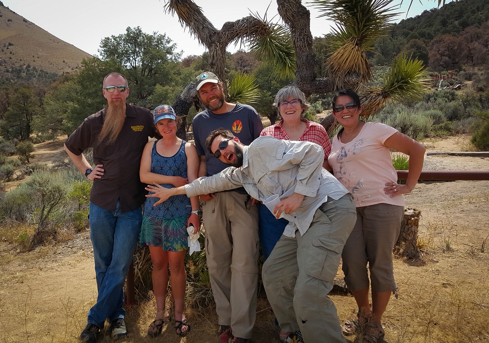
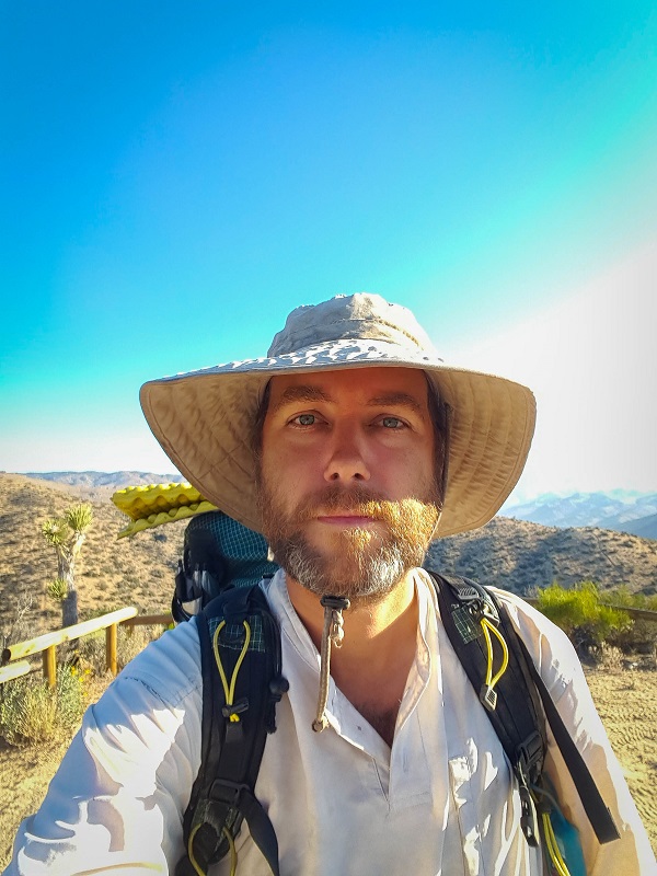
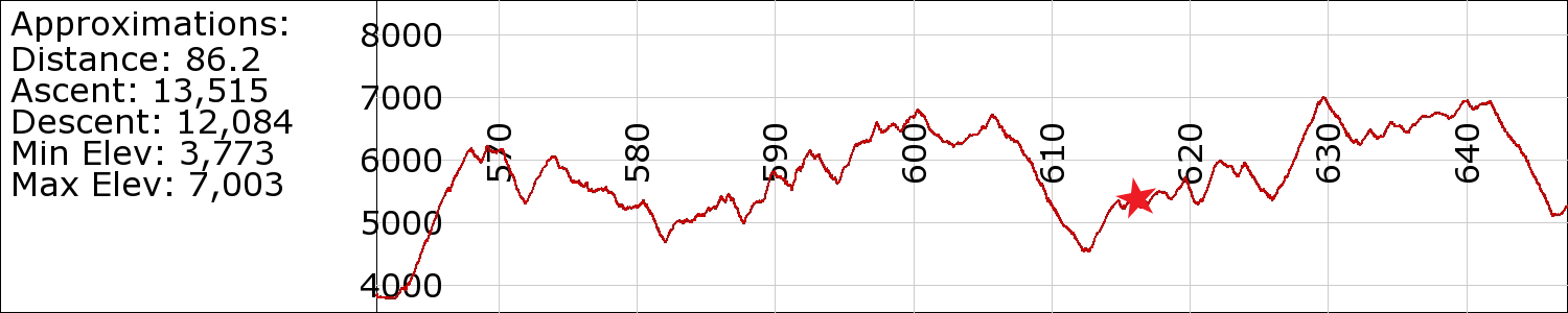
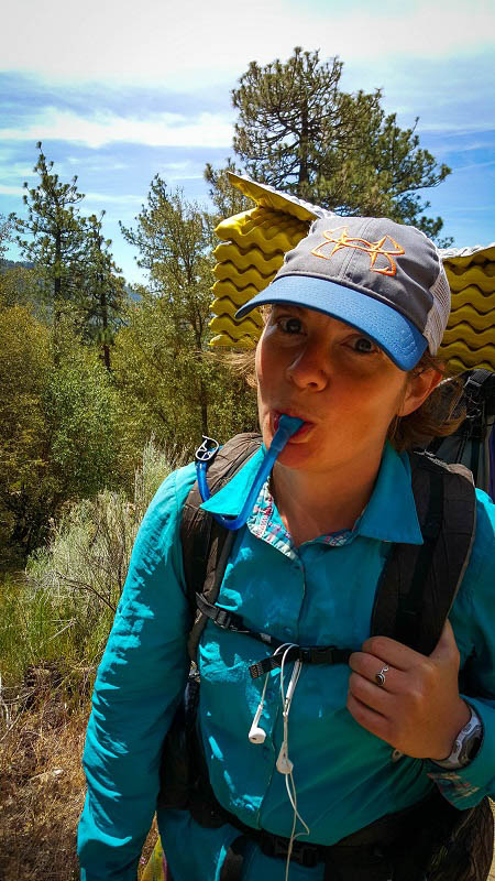
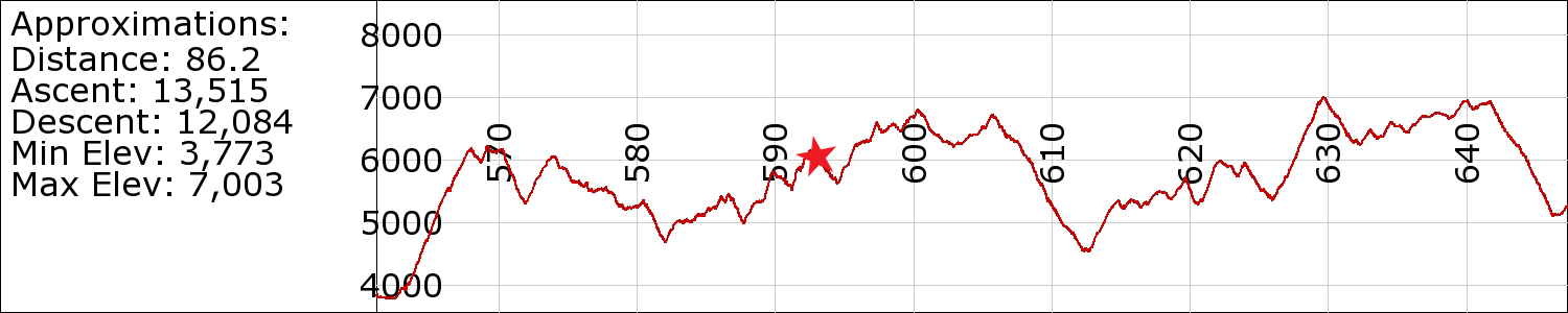
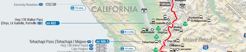
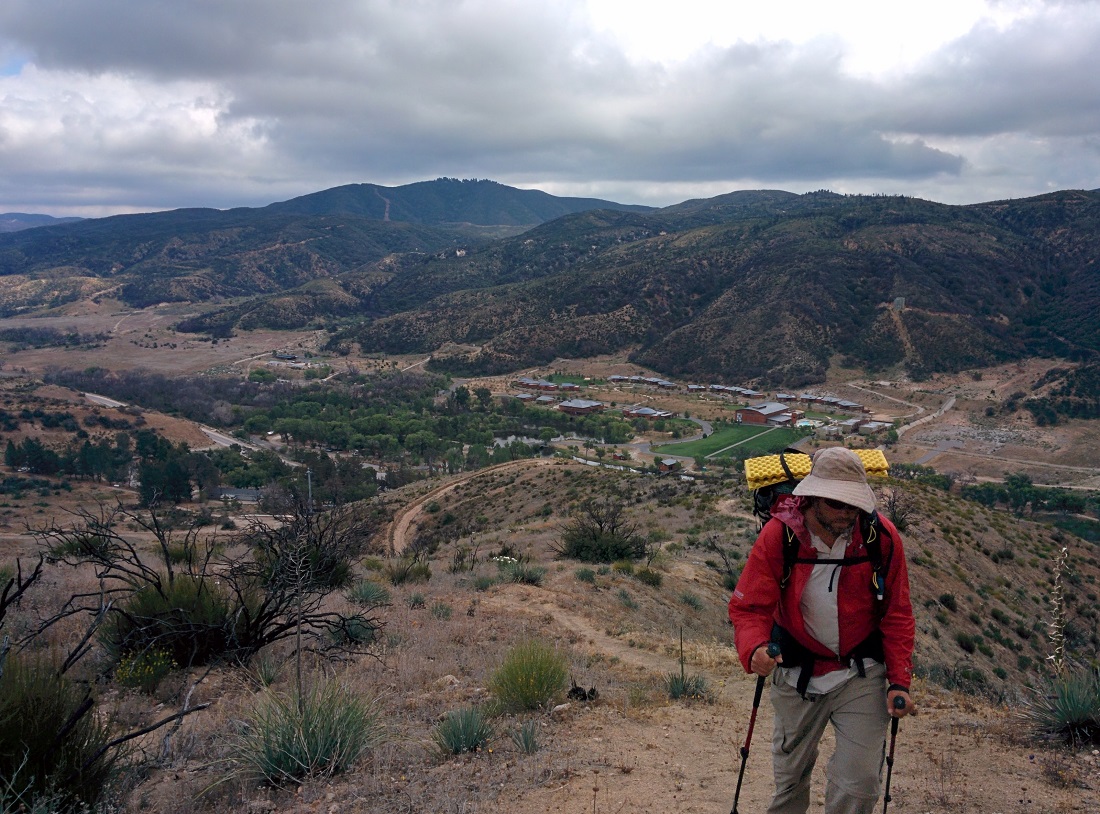
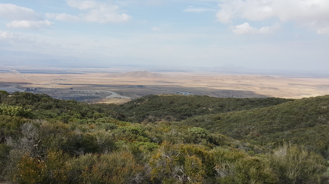
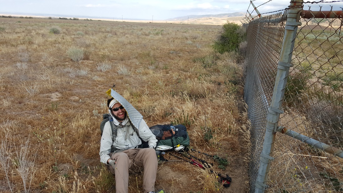
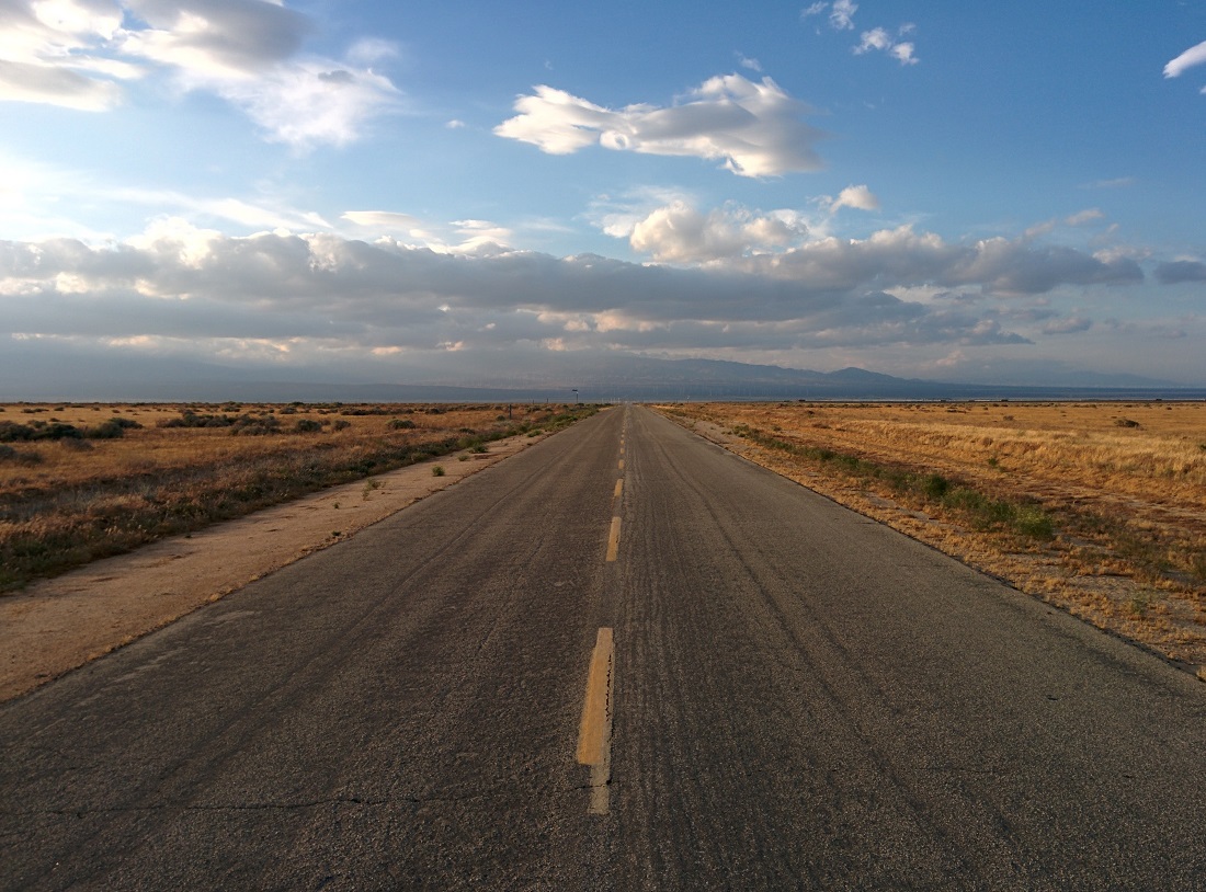
We reached Walker Pass at 10 am, yay! Six-2, Honeybadger and I got our goal done of 85 miles in 72 hours. Lemme tell you, that was a hard 85 miles. Desert sun, sand and scree, 4 liter carries and a lot of climbing. So glad to be done with Section F.
Phanstern, the Undertaker, and Nymeria met us at Walker Pass with some much appreciated trail magic. Phanstern and Undertaker were also able to fix HB’s tent! Thanks guys!
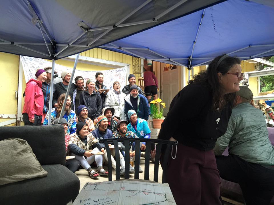
We’re headed now to OxbowBurrito’s for 2 days of R&R and some Irish music tonight in LA!
Just weighed myself. I’ve lost 25 lbs, ack! Started at 219, now 194.4.
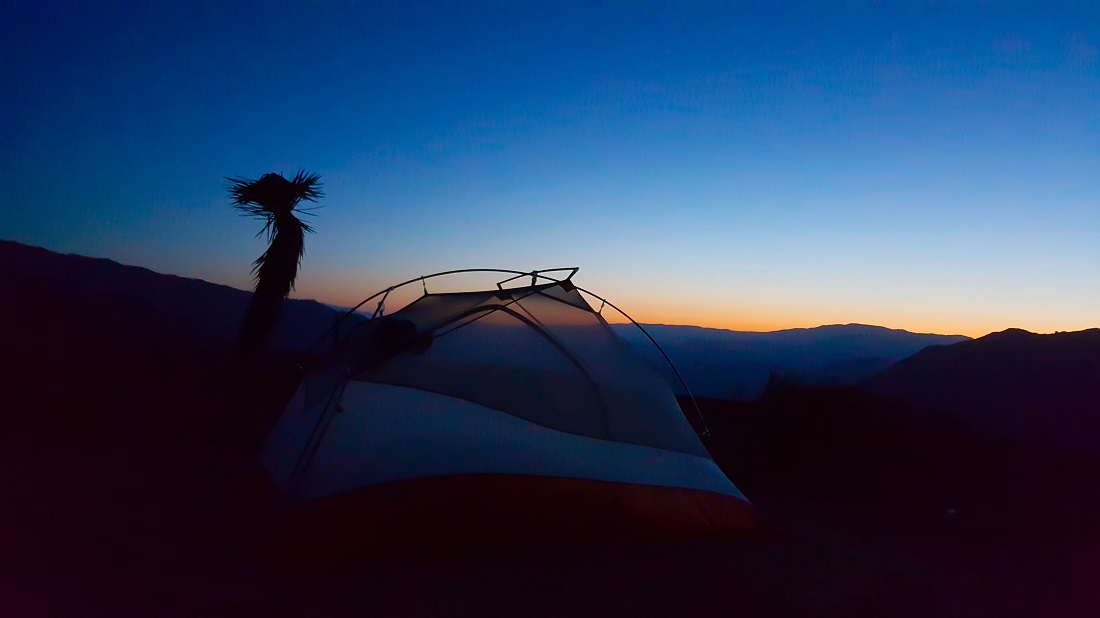
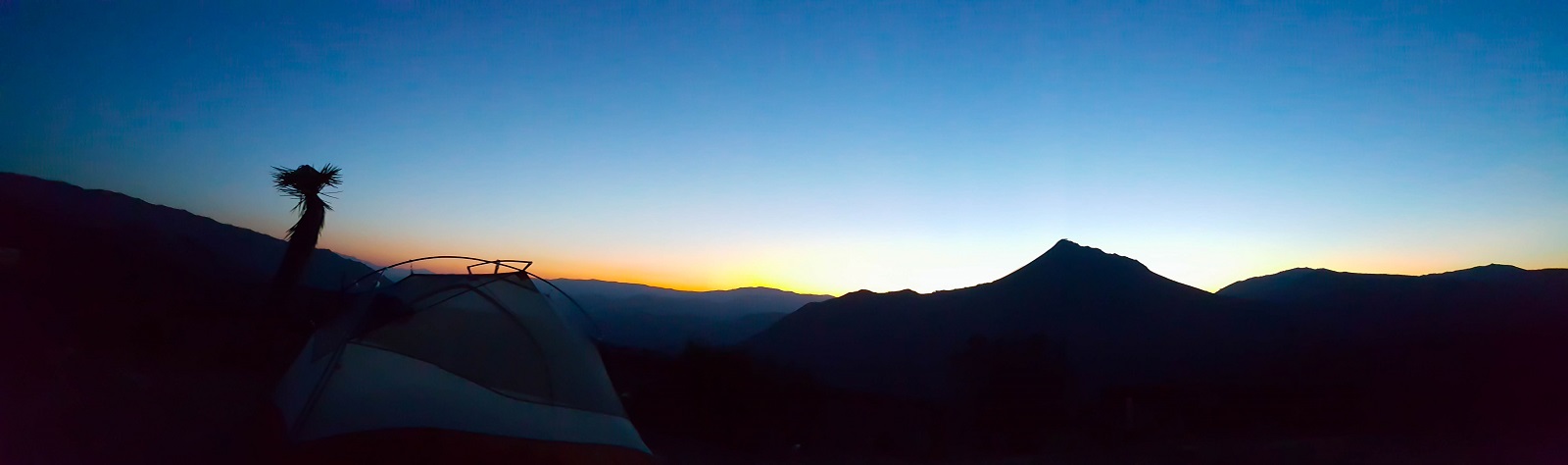
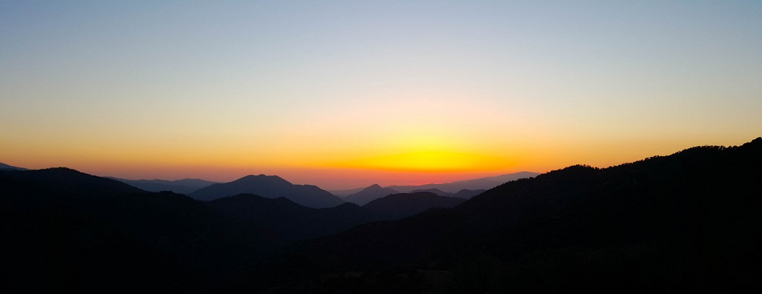
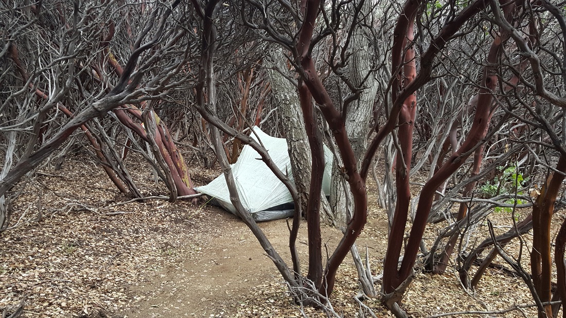
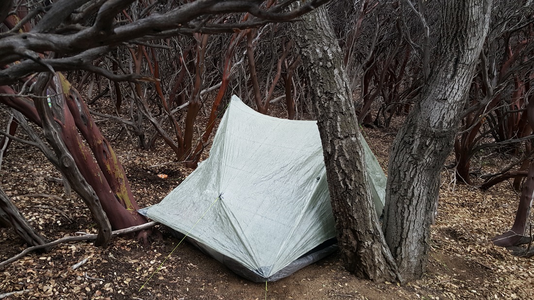
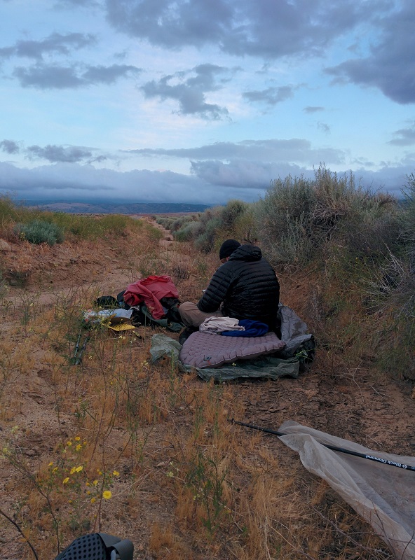
We had joked the night before that the lone Joshua Tree sticking up was the barkeep at a tiki bar. Honeybadger, Six-2 and I camped on top of a beautiful vista. We knew today was our last long full day together. Sunrise over HB’s tent:
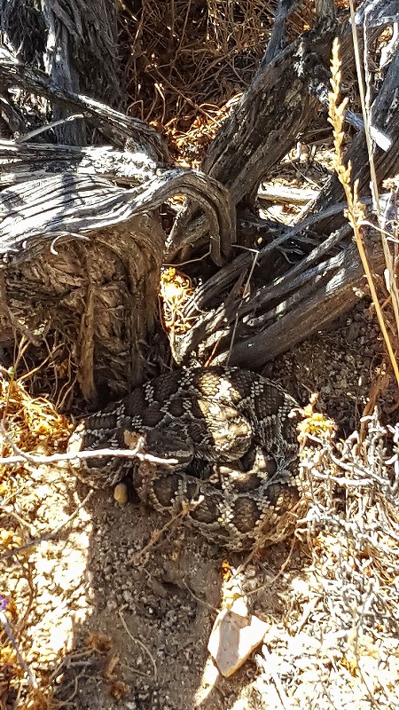
My first rattlesnake sighting of the trail. I thought it ironic that this happens only days from completing the desert portion and entering the High Sierra. I assumed I wouldn’t see any more, but I was surprised to see 3 more in North California, including a small one without a rattle.
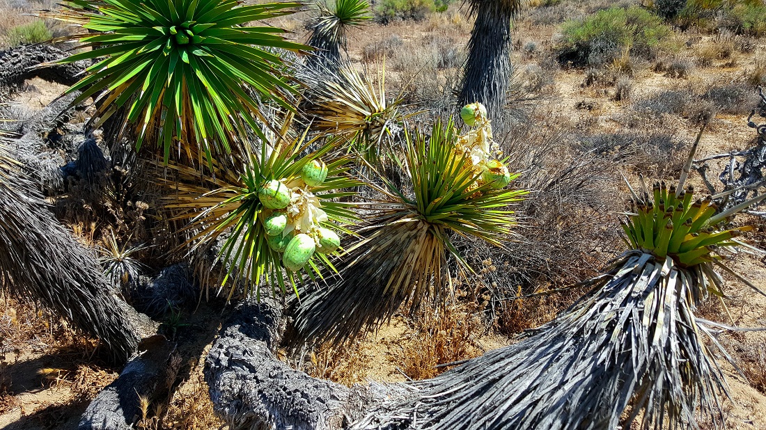
It was unusual to see Joshua Tree with their fruit.
But…but what about motorized skateboards?
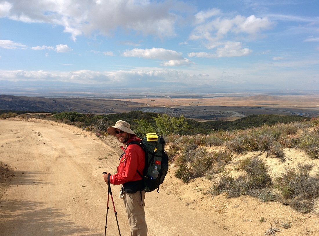
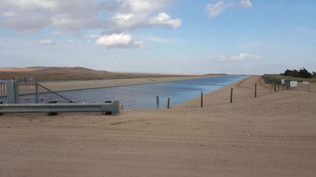
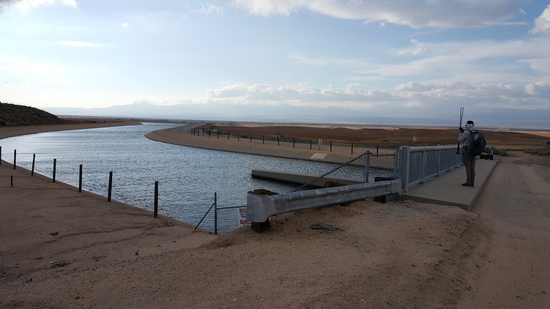
We reached Bird Spring Cache, where we’d hidden gallons of water days before with the car. Honeybadger, Six-2 and I took the most serious siesta of the trail yet, catnapping for 2 hours in what slim shade we could find. More so than the water, I was thankful for the respite from the afternoon’s heat. When we left at 5 pm for the big climb out, it was much more manageable by then.
We briefly met these British hikers. It’s hard to see, but they are camped immediately on a cliff edge. No thank you!
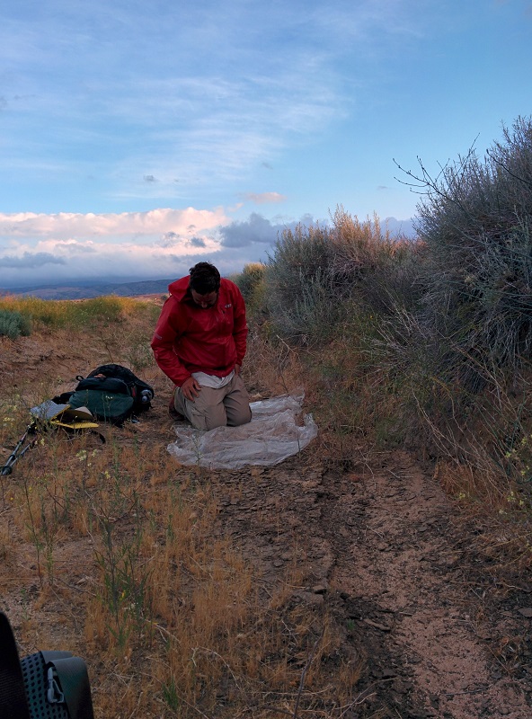
We stopped just before dark. Honeybadger unfortunately had a piece of her brand new Copper Spur tent break. Everyone was exhausted and talked about a very early morning to reach the pass on schedule.
May 27th
Total mileage: 593
Today’s mileage: 27
night-hiked til 11:30.
Yesterday, I heard a staff member from the Tehachapi airport ask if 10 am would be an ok time to water the lawn where the hikers sleep, and to please pass the word on.
Well, at 3 am, the sprinklers all popped up and fired off, and it was a bit traumatic for about 30 of us. Six-2 and I were cowboy camping at the time. Fast asleep, I was suddenly hit with water, staring up at the clear night sky, not understanding what had happened. On the sprinkler’s second revolution, Six-2 fell upon it like it was a grenade and held it off to one direction while I tried to get my bearings and get some of our gear clear. Foolishly, we moved to the most distant part of the same lawn before connecting the dots that the sprinklers were divided into segments of grass and they functioned for a set period of time, before the next segment turned on. So again, an hour later, we realized it was time to move off of the grass all together and we slept in a concrete alley on the side of a hangar.
The runway was strewn with gear today drying out.
The day is already warming up and we are all tired, but we know the big miles ahead of us.
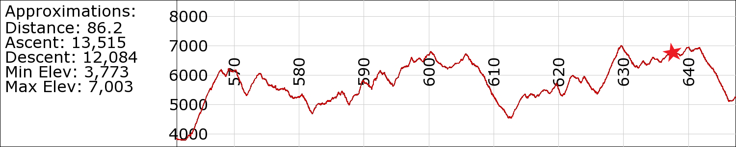
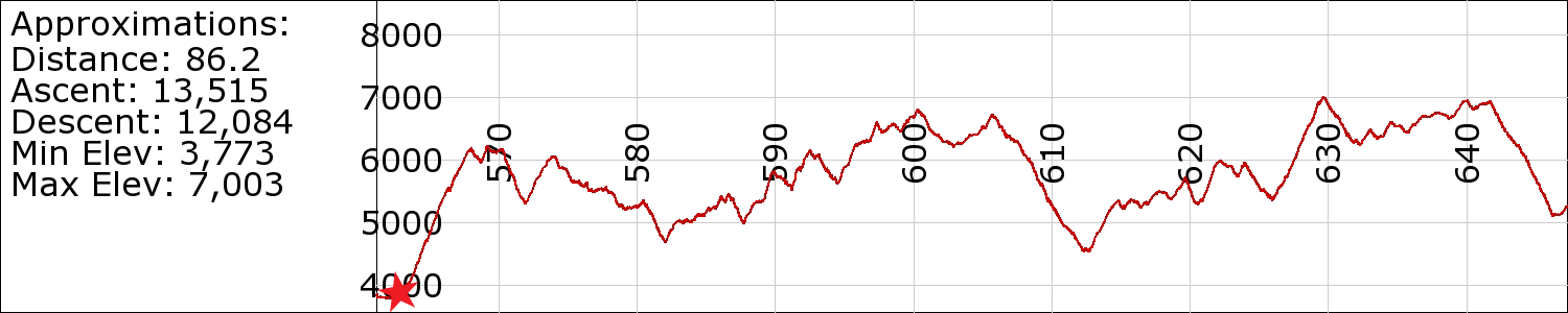
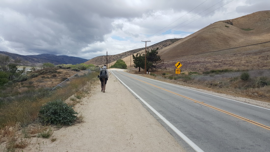
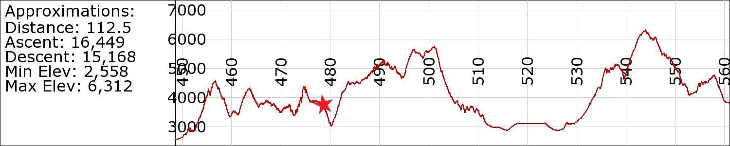
The place where we will be getting on trail today is where Cheryl of “Wild” fame began her hike back in the 90’s. Our understanding is that it isn’t a good place to start, as it’s a dry section with a lot of climbing. We have to go 85 miles in the next 72 hours. There is a very narrow window of time that I need to be at Walker Pass (10am-11am on Saturday morning), otherwise I’ll miss a concert in LA….so the pressure is tangible to really go hard the next 3 days.
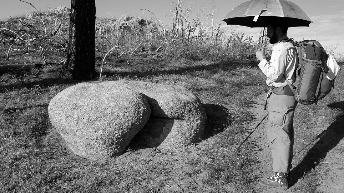
Here we see the signs of Stage 4 dehydration. The Smiths:
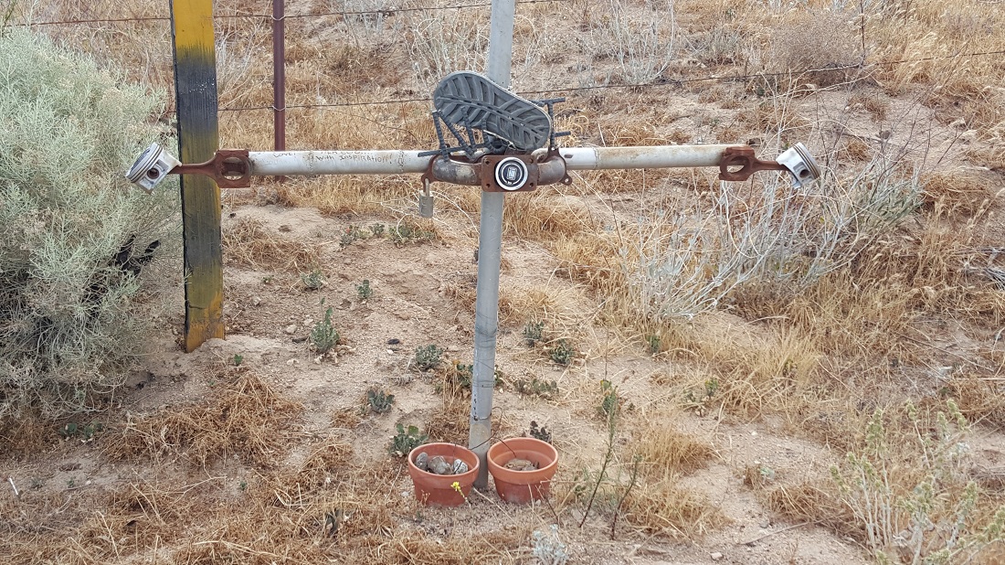
We came upon this porcelain lamb head. This is in the middle of nowhere. Can’t really explain it.
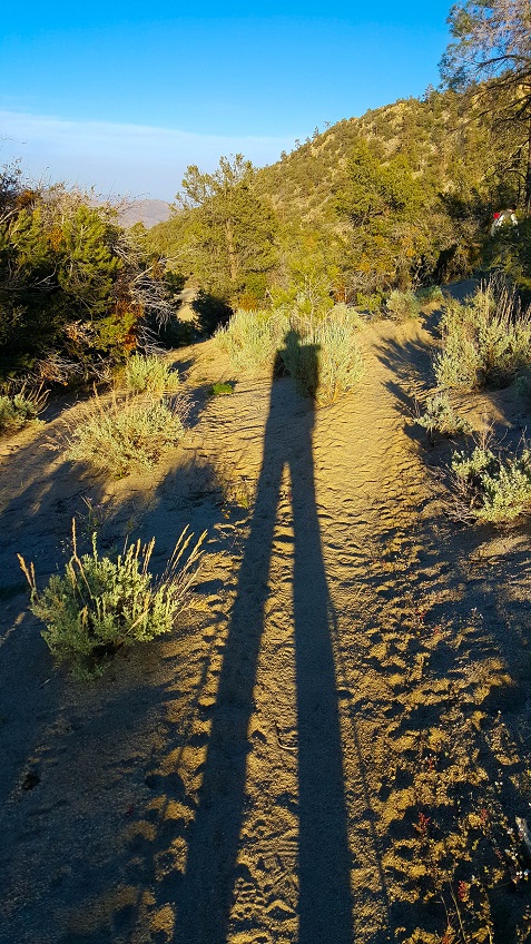
This was my first late night-hike of the trail, with Six-2 rockin’ tunes on his phone the whole time. It was a surreal, kinda eerie experience to see windmills flashing on and off in the distance, while Snoop Dogg played in the dark. Six-2 also felt the lights reminded him of a Japanese horror film, so he’d occasionally voice things like ‘come to the light’ in his best Japanese accent.
EXTRA: Joe Brewer has an excellent video showing this stretch of trail from Mojave (Mile 558) To Walker Pass (Mile 652). I highly recommend subscribing to his channel:
Today, several friends are renting a Chevy Spark together to accomplish different tasks. Six-2, Darko, Honeybadger, Taters and myself will drive out in the desert and hide gallons of water for us and strangers at Bird Spring Cache. (Update: We stashed 24 gallons; 5 for us and the remaining 19 for others.)
Deep-fried smushed-up frog legs is the best I can think of…..
We will need to do big days this week, with 25s on Wed, Thurs, and Friday, and then 10 on Sat morning. There is also a lot of elevation gain, ugh. And the historical temps we’ve managed to avoid until now are catching up. Thursday and Friday should be mid to high 90s, so we gotta be smart the next few days.
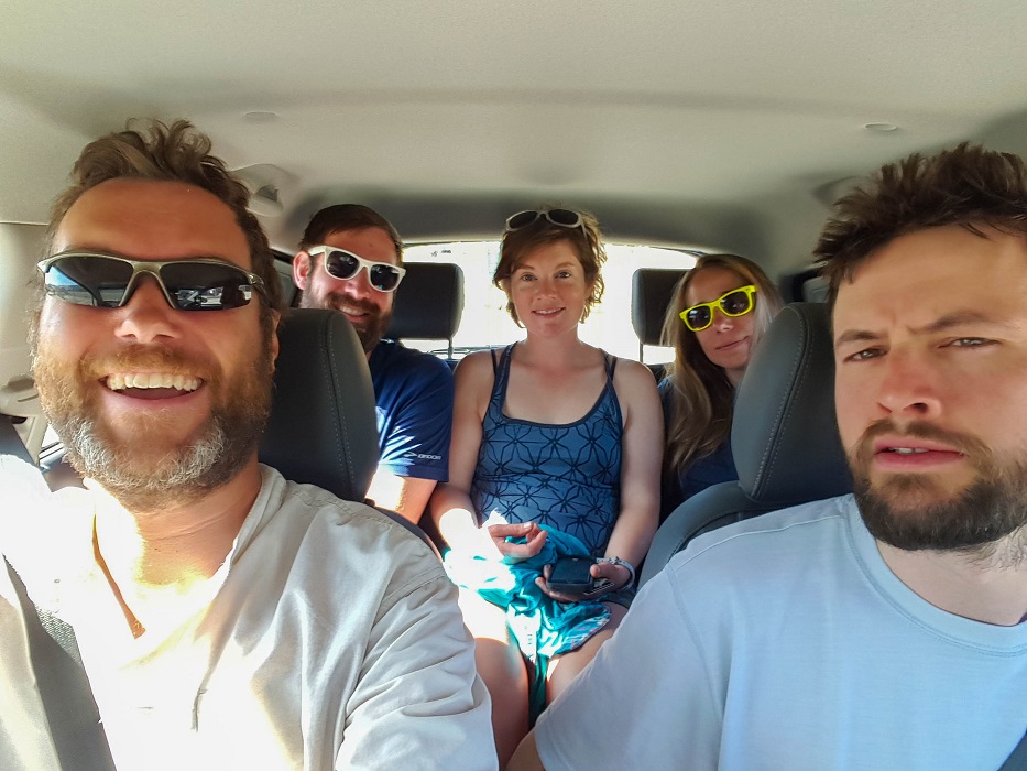
More and more hikers arrived at the Thai restaurant for dinner. When we departed, we somehow managed to fit 7 people in this Chevy Spark. I think Hendrix is beneath Recon.
Today was really nice. A group of us paid a local $5 each to return us to the remote trailhead, where we slackpacked (hiked without our gear) only 8 miles to the second highway that reaches Tehachapi. Six-2 and I saw a sight for sore eyes when Armstrong came over the horizon! We had no idea he was back on trail and in the same vicinity. We also had fun introducing ourselves for a very short stint as Pepper and Trauma (the two rockstars who hiked the PCT south through the winter a season or two ago). The first guy we met immediately showered us with adulation upon hearing ‘our’ names. Of course, we set him straight a moment later, hehe. The next group didn’t even buy it for a moment…”Bulls**t,” and he just kept hiking. 🙂 I guess we weren’t that convincing after all.
We got a return hitch within only 2-3 vehicles passing. In town, we received a text to “hurry to the matinee”, where Mad Max was showing for $5. Half of the theater was full of dirty hikertrash, while the other half seemed to be pensioners that probably have a routine of attending the theater every week, no matter what’s showing. Two women, probably in their early 80s, were sitting to my left, and they chatted the entire time through the film. I was really surprised that they didn’t mind it. We joked that it would have been nice if the film had some action. We went to a different Mexican restaurant nearby afterward, as most places were closed for Memorial Day.) We ended the day by staying at the airport, which allows hikers to camp for $5/night. They have a facility here too with a kitchen, shower, TV, etc.
We are gearing up for the rest of the week. The heat is coming. :/
I awoke exhausted. The worst night yet on trail, evidenced by the bags under my eyes and my strong-willed eyebrow. Two funny things of note. Last night, Six-2 said he was filling his water bottles in advance so that he could slip out quietly in the early morning hours…without the dog. His hope was that the dog had now bonded with other hikers in the vicinity. I had to laugh as I began to hike, for I could clearly see dog paw prints in the trail giving chase up the trail. The other funny thing is that I got to a stretch on an exposed climb, where I really really needed to go to the bathroom, and there was simply no cover available. I knew I was only a few minutes ahead of the next hikers, so once I got around a corner, I answered Nature’s call as quickly as possible on an exposed hillside. It was a close call, but I pulled it off.
At this point, we are 4 miles or less from the first of two main highways that head toward Tehachapi. It is hard not to be excited by the prospect of a shower, laundry, and libations.
At final anecdote about the dog. Another hiker in our vicinity called the number on the dog’s collar. He had Verizon, and so was able to do this…Six-2 and I were both on AT&T and we didn’t have coverage in this past stretch. The dog’s owner said he would meet us at the highway trailhead that we were headed toward. The dog was returned to him, and he generously gave $20. The funny this is, we heard from other hikers later that the dog owner was giving them a ride and he was complaining about “two a**holes who stole his dog and hiked 30 miles before calling.” Hehe. Six-2 and I looked at each other, and then he asked the person recounting the story to, “Tell us about these a**holes….”
We got a hitch to Tehachapi before too long and Six-2, Darko, Taters and myself enjoyed a nice meal at a Mexican restaurant, before moving on to a Starbucks, where I treated myself to a large Smores frappucino. It was probably 1,000 calories, and I couldn’t give a rip…it was delish.
After that, we moseyed on to the street filled with hotels. A rather hilarious situation ensued at the Marriott, were an older guy acted as though he were going to help us get the Friends & Family rate. Instead, he wasted about 30 minutes of our time, anxiously speaking with the hotel clerk and his wife (his Marriott connection), before summarily declaring, “I’m sorry to have gotten your hopes up guys, but something about this one (he pointed at Taters) really torques me.” And then he left. We remained sitting on the hotel lobby couches for a few minutes, bemused and marveling at the character we had just encountered. So instead, we settled for Best Western next door, which was only $25 each, and took turns showering and regaining a sliver of our humanity. I washed my clothes in the sink with some Brohmers soap I had carried, but my well-meaning roommates encouraged me to throw my clothes in the real washing machine with their own. Hehe, in retrospect, I probably shouldn’t have. Once I opened the lid of the machine, I stared into the abyss of a chalky-black-pea soup. I threw my clothes in, but reflected that they probably were not going to be cleaner than they were from my hand washing, doh.
Six-2 and I shuffled slowly in flip-flops on the asphalt over to the Kmart, and he bought the cheapest town outfit he could. Then we met the others at a nearby pizzeria. It was a nice day.
May 23rd
Total mileage: approx. 542
Today’s mileage: uncertain
Early in the morning, we walked past two massive solar farms. At one point, a security guard pulled his pickup over and chatted us up. Six-2 had the audacity to shake him down for snacks, hehe. He kindly shared a bar of some sort from his lunch. He had trouble wrapping his mind around what we were doing, and asked if he could photograph us for his Facebook site.
During this monotonous straight stretch, Six-2 demonstrated a variety of creative vaudeville acts, including: 1) dancing to “Putting on the Ritz” with his trekking poles like a dancing cane; 2) producing and acting in a very short film about the Yucca-man (think Blair Witch Project); 3) rolling his chocolate-chip Clif bars into ‘dog turds’, placing them on the street and pretending like he just found them; and lastly and the most damning of all, 4) befriending an unchained dog who would proceed to follow us over 30 miles to Tehachapi.
For your viewing pleasure:
My rare footage of the elusive Yucca-man…never-before captured on film.
By this point, Six-2 was already ignoring the dog and trying to shush him home. But the dog wouldn’t have any of it. He pestered us for food. He seemed desperate for water. This water source featured below was a rather peculiar scenario. All around this portion of the wind farm were gates with “No Trespassing” signs. Our PCT pathfinding apps, like Half-Mile, said that there was definitely a water source in here for hikers, and we were relying on it being there. Still, it was weird to once again ignore No Trespassing signs and plodder on. In the photo below, you can see how only the spigot sticks out through the fence. The dog was pawing at the ground beneath the spigot and Six-2 compassionately gave him water.
By this point, my funometer had fallen off for the day. I think my disposition was affected by little sleep the night before.
As evidenced by the above videos, it was an extremely taxing day in the wind farm. There was just no respite from it, and it felt like each windmill was half a mile from the next. We spent hours toiling through it, eventually reaching a known water source/”camp site” called Tyler Horse Creek Canyon at 3 pm. I was really exhausted at this point, and we knew the next site was on the order of 5 miles away with already too many hikers headed that way, so we called it a day. By 5pm, we both had batted down the hatches by climbing into our sleeping bags. By 6pm, our friends Darko and Taters arrived and they laughed at the situation they found us in. Taters said that I sat up in my sleeping bag with my down balaclava on, so only my eyes were visible, and I said, “This place sucks!” Hehe. She said she already knew it the moment they had arrived.
The wind was terribly fierce coming down the canyon. You could hear a gust enter the very top, and it was like hearing a roller coaster at an amusement park ride. It was about a 6-second count from the time I first heard it before the gust would slam into me. Soon enough, you learned to gauge the severity of a particular gust, and you had enough time to be alert or grip your belongings extra tight if you knew a particularly bad one was about to hit. It was long and miserable night.
May 22nd
Total mileage: uncertain
Today’s mileage: uncertain
Every morning, Terry Anderson moons the group as they get photographed, hehe. Photo courtesy of Lou Lou Brown. You can see myself, Six-2, The Animal, Siren, Snackies and Lumberjack in there, amongst many others.
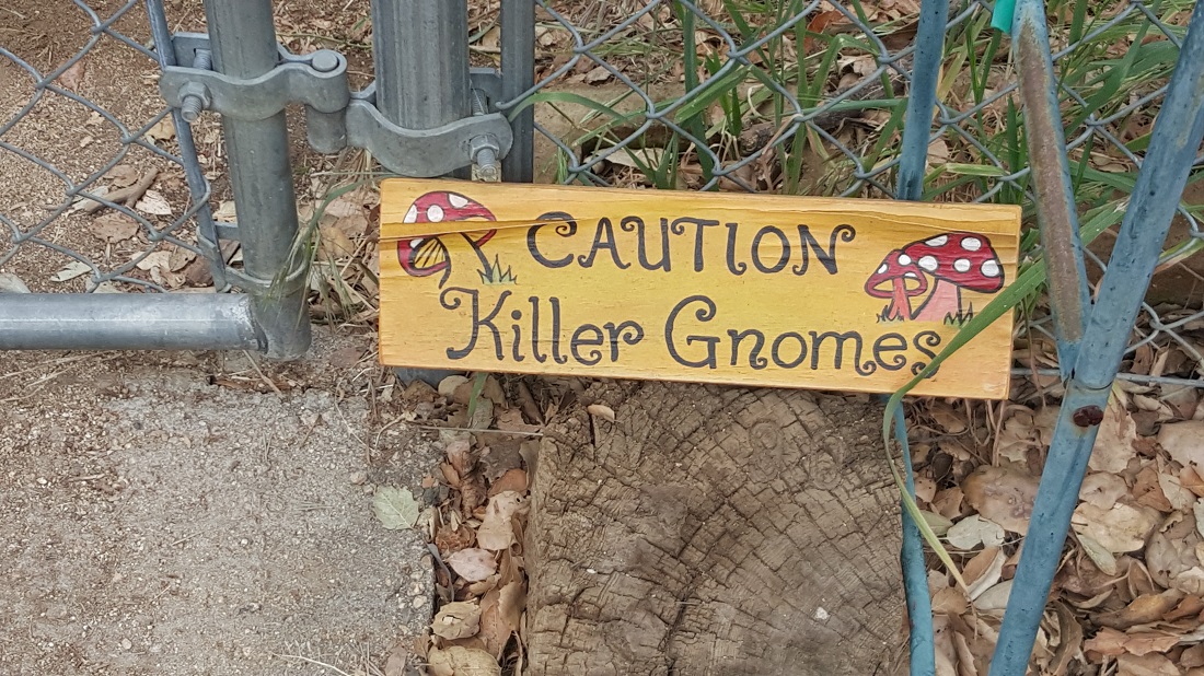
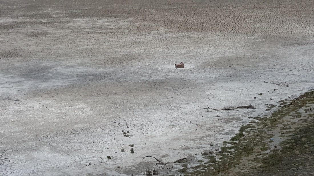
After pancakes and coffee at the Anderson’s, Terry kindly gave Six-2 and me a ride back to the trailhead. We had something like a 5 mile walk around Lake Hughes, during which time, we saw welcoming signs such as this, and a dry lake-bed with a shopping cart in the center.
It’s hard to tell in this photo, but that tree actually leans over the dry lakebed, and the remnants of a tree swing remain.
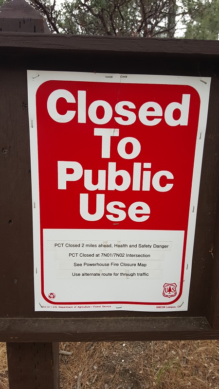
We ate an expensive meal at a pub called The Rock (Not the national chain). At this point, there was yet again another trail closure. (Our first one was a fire closure near Idyllwild, our second was after Baden-Powell due to an endangered species.) Once again, hikers are left to their own devices to decide how/when/where to return to the trail. Six-2 felt a sense of urgency to reach Tehachapi sooner rather than later, and advocated for hiking north across the Mojave, rather than a 20-mile road walk west/northwest to Hikertown.
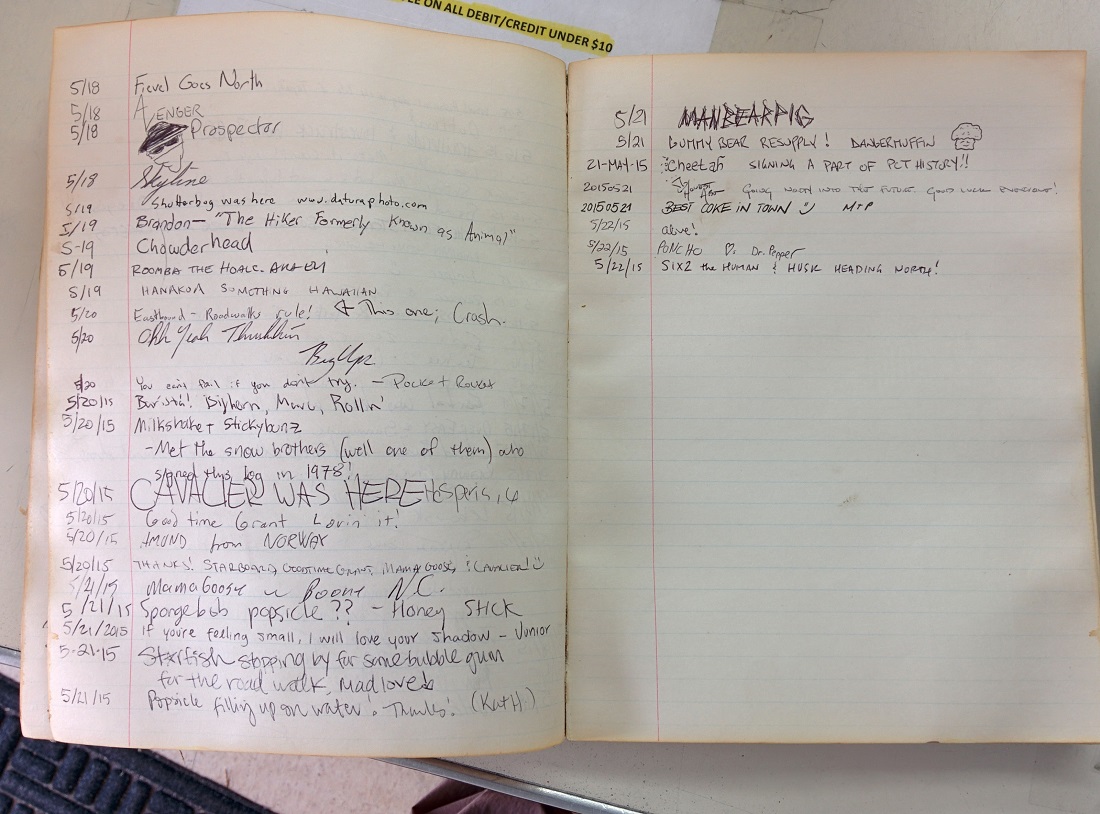
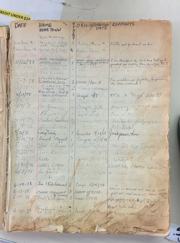
The trail register in the general store.Entries from 1977!
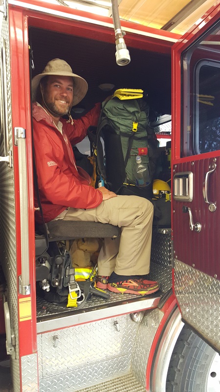
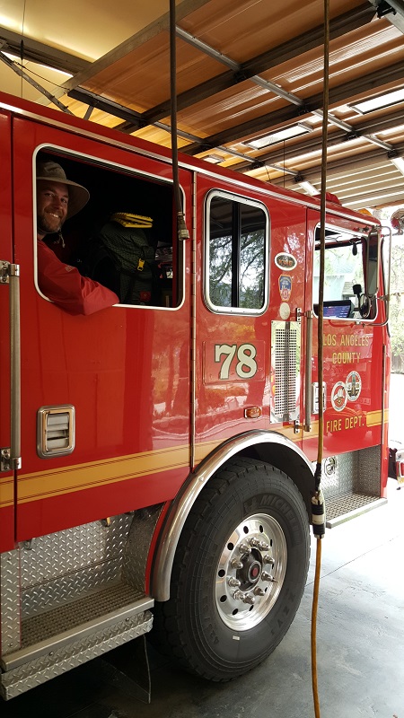
As fate would have it, we ran into two firefighters at the general store, and after hearing Six-2’s plan, one of them lit up with enthusiasm. “I tell this to hikers every year! You’re hiking north to Canada, just go north!” He then proceeded to invite us to ride some 2 miles back to the fire station in his fire engine. (We had passed by it earlier prior to lunch.) Six-2 was thoroughly impressed, and felt that this hitch exceeded his previous best of an ice cream truck.
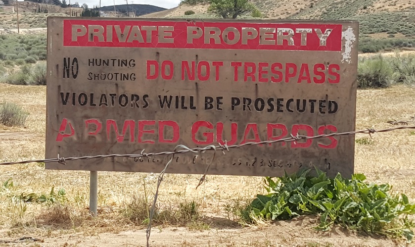
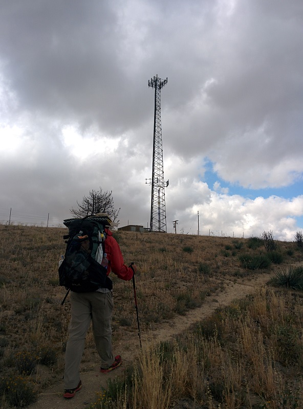
Once at the station, the firefighter pointed to a map and said Six-2’s plan was absolutely solid and the right thing to do. He said something to the effect: “There’s a cell tower on top of the hill immediately behind our station. There’s a little barbed wire fence there, but it won’t be a problem getting through it…it’s like from the 50s or something. And then you’re scott-free. Just head north through the Mojave.” The best-laid plans….right?
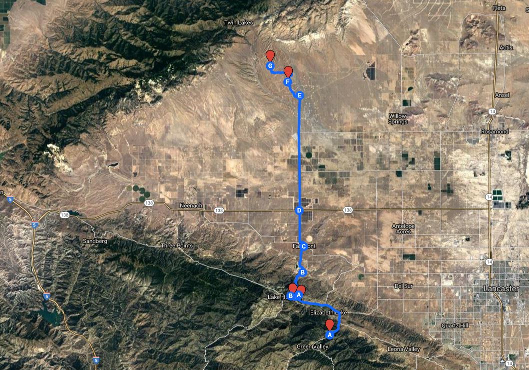
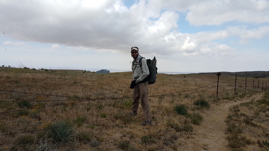
Ultimately, this is the path we took.
This part was still easy peasy.
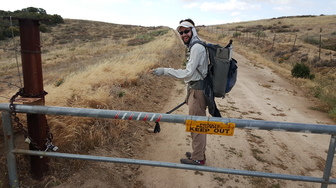
Over several of the early fences. The worst is yet to come!
We knew we just needed to get down to that flat terrain, but the gates became progressively worse.
Things were going ok, until we ran into this one.
The back gate was unlocked. By we both had a sneaky suspicion that we’d have a harder time getting out the “front” side.
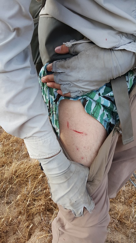
We found the single section that had a horizontal support strut on the internal side. I went over first, and used my Zlite sol pad to cover the barbed wire. I could just feel the barbs coming through. Apparently, it’s been awhile since I’ve climbed a chain-link fence. The toe box of my shoes was too wide to fit into the holes, lol, so I had a harder time coming down than I expected. We noticed that Six-2 had a hole in his pants, and at first he thought he didn’t get punctured, but later on he admitted his thigh was itchy and decided he better investigate. He paid the price!
Nothing too serious, however. We saw a farmhouse in the distance and feared we were still not on public land, but soon enough we saw the backside of an official traffic sign and were relieved to be in ‘safe territory’. We hiked about another mile, looking for a place with some protection from the wind.
A large hawk made very angry sounds at us as we approached what was presumably his roost, but we had to press on and he followed with us for a 100 meters or more. I may have hiked with my poles facing upward for awhile to discourage him diving at us, hehe.
Photos courtesy of Six-2.
We spent the night in a ditch next to a paved highway on the outskirts of Lancaster, about a half day south from the first wind farm.
May 21st
Total mileage: 478
Today’s mileage: 24 (+1 roadwalk)
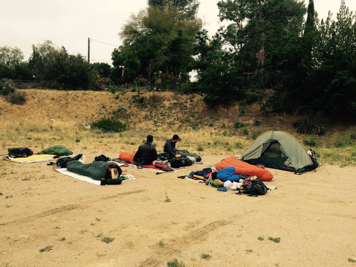
Cool day, long water carry ahead of 25 miles. We slept in a grocery store parking lot last night, hehe. Hoping to make the Andersons by 6:30 for taco salads.
TrailAngel GoalTech took a photo of this motley crew, somewhere around mile 472. (L-R) Mack, Six-2, Hendrix, Tiny Dancer and The Husk.A bunch of us got permission from the grocery store to sleep in their parking lot the night before. We didn’t have enough time to get out of town and this was the best option available. Hendrix, Six-2 and yours truly are seen here. Photo courtesy of The Animal.
Hendrix and the Ague Dulce monster. Hendrix is the one in the green.
Strange junkyard(?) with airplane. I’ve heard this is used for filming movies, but uncertain.The day felt like this…over and over again. Ascending into fog. This stretch is notorious hot. I knew we were super lucky with the cooler weather.Mac, Tiny Dancer and Recon en route to the Anderson’s.Strange, but sitting on the trail was really the best place to eat lunch. Mac, Hendrix and Tiny Dancer.A couple of ultrarunning heroes I met before, Scott Jurek and Kristin Moehl. Cool!